
Aloha topographic map
Interactive map
Click on the map to display elevation.
About this map
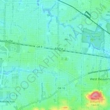
Name: Aloha topographic map, elevation, terrain.
Location: Aloha, Washington County, Oregón, Estados Unidos (45.46653 -122.90512 45.51629 -122.84113)
Average elevation: 66 m
Minimum elevation: 46 m
Maximum elevation: 153 m