
Flevoland topographic map
Click on the map to display elevation.
About this map
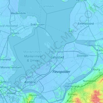
Name: Flevoland topographic map, elevation, terrain.
Location: Flevoland, Netherlands (52.24953 5.06043 52.84398 6.01730)
Average elevation: 1 m
Minimum elevation: -9 m
Maximum elevation: 96 m
Other topographic maps
Click on a map to view its topography, its elevation and its terrain.