
Bowling Green topographic map
Interactive map
Click on the map to display elevation.
About this map
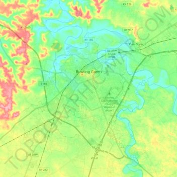
Name: Bowling Green topographic map, elevation, terrain.
Location: Bowling Green, Warren County, Kentucky, 42101, USA (36.89885 -86.53321 37.04665 -86.30672)
Average elevation: 169 m
Minimum elevation: 127 m
Maximum elevation: 248 m