
Braunfels topographic map
Interactive map
Click on the map to display elevation.
About this map
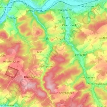
Name: Braunfels topographic map, elevation, terrain.
Location: Braunfels, Lahn-Dill-Kreis, Hessen, Duitsland (50.45623 8.31057 50.54850 8.45392)
Average elevation: 241 m
Minimum elevation: 133 m
Maximum elevation: 356 m