
Thank you for supporting this site ❤️
Make a donation
Make a donation
Istrana topographic map
Click on the map to display elevation.
Thank you for supporting this site ❤️
Make a donation
Make a donation
About this map
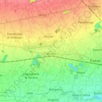
Name: Istrana topographic map, elevation, terrain.
Location: Istrana, Treviso, Veneto, 31036, Italy (45.63756 12.06029 45.72431 12.12171)
Average elevation: 39 m
Minimum elevation: 11 m
Maximum elevation: 70 m
Thank you for supporting this site ❤️
Make a donation
Make a donation