
Lam Luk Ka District topographic map
Interactive map
Click on the map to display elevation.
About this map
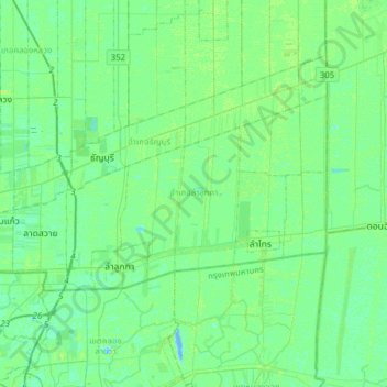
Name: Lam Luk Ka District topographic map, elevation, terrain.
Location: Lam Luk Ka District, Pathum Thani Province, Thailand (13.91627 100.60511 14.06824 100.91484)
Average elevation: 4 m
Minimum elevation: -8 m
Maximum elevation: 9 m
Other topographic maps
Click on a map to view its topography, its elevation and its terrain.
Khu Khot Town Municipality
Thailand > Pathum Thani Province > Lam Luk Ka District > Khu Khot Town Municipality
Khu Khot Town Municipality, Lam Luk Ka District, Pathum Thani Province, Thailand
Average elevation: 5 m
Pathum Thani Town Municipality
Thailand > Pathum Thani Province > Mueang Pathum Thani District
Pathum Thani Town Municipality, Mueang Pathum Thani District, Pathum Thani Province, Thailand
Average elevation: 5 m
Khu Khot
Thailand > Pathum Thani Province > Khu Khot
Khu Khot, Lam Luk Ka District, Pathum Thani Province, 12130, Thailand
Average elevation: 4 m
Pathum Thani
Thailand > Pathum Thani Province > Pathum Thani
Pathum Thani, Mueang Pathum Thani, Pathum Thani Province, 12160, Thailand
Average elevation: 4 m