
Bastogne topographic map
Click on the map to display elevation.
Bastogne
The municipality consists of the following districts: Bastogne, Longvilly, Noville, Villers-la-Bonne-Eau, and Wardin. The town is situated on a ridge in the Ardennes at an elevation of 510 metres (1,670 ft).
About this map
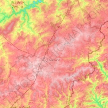
Name: Bastogne topographic map, elevation, terrain.
Location: Bastogne, Luxembourg, Wallonia, 6600, Belgium (49.90936 5.63835 50.11722 5.86987)
Average elevation: 465 m
Minimum elevation: 284 m
Maximum elevation: 562 m