
Ghardaia topographic map
Interactive map
Click on the map to display elevation.
About this map
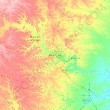
Name: Ghardaia topographic map, elevation, terrain.
Location: Ghardaia, Ghardaia District, Ghardaia, 47000, Algeria (32.32586 3.51710 32.64586 3.83710)
Average elevation: 549 m
Minimum elevation: 414 m
Maximum elevation: 702 m
Other topographic maps
Click on a map to view its topography, its elevation and its terrain.