
Thank you for supporting this site ❤️
Make a donation
Make a donation
Volga River topographic map
Click on the map to display elevation.
Thank you for supporting this site ❤️
Make a donation
Make a donation
About this map
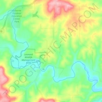
Name: Volga River topographic map, elevation, terrain.
Location: Volga River, Clayton County, Iowa, United States (42.75136 -91.44409 42.79575 -91.36886)
Average elevation: 268 m
Minimum elevation: 211 m
Maximum elevation: 358 m
Thank you for supporting this site ❤️
Make a donation
Make a donation
Other topographic maps
Click on a map to view its topography, its elevation and its terrain.
Thank you for supporting this site ❤️
Make a donation
Make a donation
Thank you for supporting this site ❤️
Make a donation
Make a donation