
Thank you for supporting this site ❤️
Make a donation
Make a donation
Wannebecq topographic map
Click on the map to display elevation.
Thank you for supporting this site ❤️
Make a donation
Make a donation
About this map
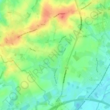
Name: Wannebecq topographic map, elevation, terrain.
Location: Wannebecq, Lessines, Ath, Hainaut, Wallonie, 7861, Belgique (50.67915 3.75795 50.70864 3.81239)
Average elevation: 39 m
Minimum elevation: 19 m
Maximum elevation: 64 m
Thank you for supporting this site ❤️
Make a donation
Make a donation