

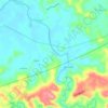
Lawaan topographic map
Click on the map to display elevation.
About this map

Name: Lawaan topographic map, elevation, terrain.
Location: Lawaan, Northern Samar, Eastern Visayas, Philippines (12.50518 124.99489 12.54518 125.03489)
Average elevation: 6 m
Minimum elevation: -2 m
Maximum elevation: 61 m
Other topographic maps
Click on a map to view its topography, its elevation and its terrain.

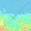


Biri Larosa Protected Landscape and Seascape
Philippines > Northern Samar > Biri
Average elevation: 12 m


San Antonio
The highest point of the island is in its central southern portion with a maximum elevation of 35 meters (115 ft) above sea level.
Average elevation: 56 m


