Prinz-Luitpold-Haus topographic map
Interactive map
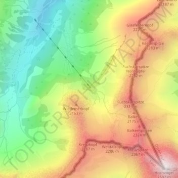
Click on the map to display elevation.
About this map
Name: Prinz-Luitpold-Haus topographic map, elevation, terrain.
Average elevation: 1,833 m
Minimum elevation: 1,196 m
Maximum elevation: 2,564 m

Click on the map to display elevation.
Name: Prinz-Luitpold-Haus topographic map, elevation, terrain.
Average elevation: 1,833 m
Minimum elevation: 1,196 m
Maximum elevation: 2,564 m