
Thank you for supporting this site ❤️
Make a donation
Make a donation
San Francisco Javier topographic map
Click on the map to display elevation.
Thank you for supporting this site ❤️
Make a donation
Make a donation
About this map
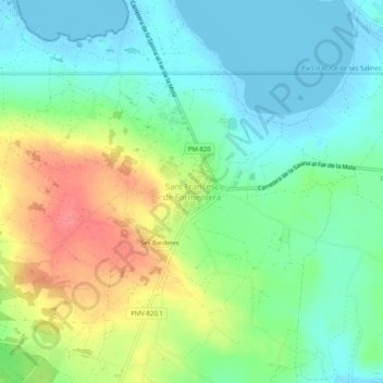
Name: San Francisco Javier topographic map, elevation, terrain.
Location: San Francisco Javier, Formentera, Islas Baleares, 07860, España (38.66540 1.38844 38.74540 1.46844)
Average elevation: 17 m
Minimum elevation: -5 m
Maximum elevation: 106 m
Thank you for supporting this site ❤️
Make a donation
Make a donation
Other topographic maps
Click on a map to view its topography, its elevation and its terrain.