
Kirchheide topographic map
Interactive map
Click on the map to display elevation.
About this map
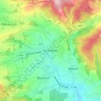
Name: Kirchheide topographic map, elevation, terrain.
Location: Kirchheide, Lemgo, Kreis Lippe, Nordrhein-Westfalen, Deutschland (52.06318 8.84664 52.10318 8.88664)
Average elevation: 200 m
Minimum elevation: 126 m
Maximum elevation: 333 m