
Hemel Hempstead topographic map
Interactive map
Click on the map to display elevation.
About this map
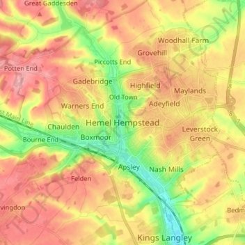
Name: Hemel Hempstead topographic map, elevation, terrain.
Average elevation: 130 m
Minimum elevation: 70 m
Maximum elevation: 178 m
Other topographic maps
Click on a map to view its topography, its elevation and its terrain.
Old Town
United Kingdom > England > Hertfordshire > Dacorum
Old Town, Dacorum, Hertfordshire, England, HP1 3AF, United Kingdom
Average elevation: 124 m
Berkhamsted
United Kingdom > England > Hertfordshire > Dacorum > Berkhamsted
Berkhamsted, Dacorum, Hertfordshire, England, United Kingdom
Average elevation: 142 m