
Thank you for supporting this site ❤️
Make a donation
Make a donation
Matar Taluka topographic map
Click on the map to display elevation.
Thank you for supporting this site ❤️
Make a donation
Make a donation
About this map
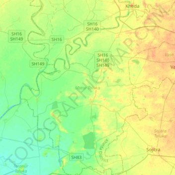
Name: Matar Taluka topographic map, elevation, terrain.
Location: Matar Taluka, Kheda District, Gujarat, India (22.50007 72.50478 22.75984 72.77412)
Average elevation: 22 m
Minimum elevation: 9 m
Maximum elevation: 36 m
Thank you for supporting this site ❤️
Make a donation
Make a donation
Other topographic maps
Click on a map to view its topography, its elevation and its terrain.