
Bruschied topographic map
Interactive map
Click on the map to display elevation.
About this map
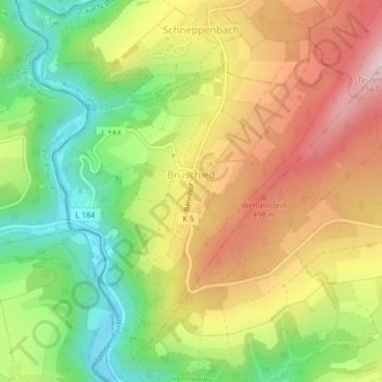
Name: Bruschied topographic map, elevation, terrain.
Average elevation: 390 m
Minimum elevation: 239 m
Maximum elevation: 550 m
Other topographic maps
Click on a map to view its topography, its elevation and its terrain.
Langenthal
Allemagne > Rhénanie-Palatinat > Landkreis Bad Kreuznach > Langenthal
Langenthal, Nahe-Glan, Landkreis Bad Kreuznach, Rhénanie-Palatinat, Allemagne
Average elevation: 319 m