
La Pililla topographic map
Interactive map
Click on the map to display elevation.
About this map
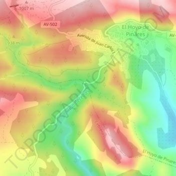
Name: La Pililla topographic map, elevation, terrain.
Location: La Pililla, Cebreros, Ávila, Castile and León, 05250, Spain (40.49348 -4.43226 40.49355 -4.43192)
Average elevation: 901 m
Minimum elevation: 761 m
Maximum elevation: 1,023 m
Other topographic maps
Click on a map to view its topography, its elevation and its terrain.
Cerro de la Estrella
Spain > Castile and León > Cebreros
Cerro de la Estrella, Cebreros, Ávila, Castile and León, 05260, Spain
Average elevation: 1,006 m