
Thank you for supporting this site ❤️
Make a donation
Make a donation
Abée topographic map
Click on the map to display elevation.
Thank you for supporting this site ❤️
Make a donation
Make a donation
About this map
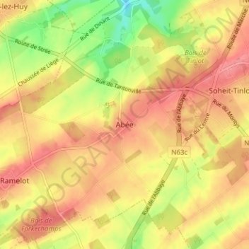
Name: Abée topographic map, elevation, terrain.
Location: Abée, Tinlot, Huy, Liège, Wallonie, 4557, Belgique (50.45353 5.33646 50.49353 5.37646)
Average elevation: 258 m
Minimum elevation: 212 m
Maximum elevation: 286 m
Thank you for supporting this site ❤️
Make a donation
Make a donation
Other topographic maps
Click on a map to view its topography, its elevation and its terrain.
Thank you for supporting this site ❤️
Make a donation
Make a donation