
Burunga topographic map
Interactive map
Click on the map to display elevation.
About this map
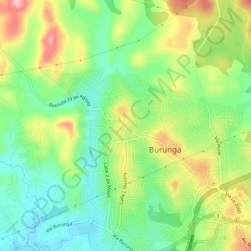
Name: Burunga topographic map, elevation, terrain.
Location: Burunga, Distrito Arraiján, Panamá Oeste, Panamá (8.95086 -79.69215 8.99086 -79.65215)
Average elevation: 94 m
Minimum elevation: 28 m
Maximum elevation: 193 m