
Appalachians topographic map
Interactive map
Click on the map to display elevation.
About this map
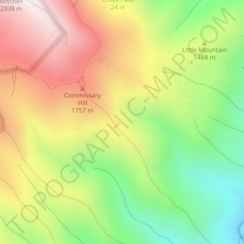
Name: Appalachians topographic map, elevation, terrain.
Location: Appalachians, Yancey County, North Carolina, USA (35.74995 -82.25005 35.75005 -82.24995)
Average elevation: 1,463 m
Minimum elevation: 962 m
Maximum elevation: 2,002 m
Other topographic maps
Click on a map to view its topography, its elevation and its terrain.
Timberland
USA > North Carolina > Timberland
Timberland, Hoke County, North Carolina, USA
Average elevation: 99 m
Mount Mitchell
Mount Mitchell, Yancey County, North Carolina, USA
Average elevation: 1,743 m
Southern Nantahala Wilderness
Southern Nantahala Wilderness, Appalachian Trail, Macon County, North Carolina, USA
Average elevation: 957 m
West Philadelphia
USA > North Carolina > West Philadelphia
West Philadelphia, Moore County, North Carolina, USA
Average elevation: 150 m