
Thank you for supporting this site ❤️
Make a donation
Make a donation
New Broughton topographic map
Click on the map to display elevation.
Thank you for supporting this site ❤️
Make a donation
Make a donation
About this map
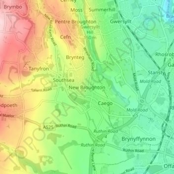
Name: New Broughton topographic map, elevation, terrain.
Location: New Broughton, Wrexham, Wales, LL11 6SF, United Kingdom (53.03808 -3.05242 53.07808 -3.01242)
Average elevation: 136 m
Minimum elevation: 49 m
Maximum elevation: 272 m
Thank you for supporting this site ❤️
Make a donation
Make a donation
Other topographic maps
Click on a map to view its topography, its elevation and its terrain.