
Ghoy topographic map
Interactive map
Click on the map to display elevation.
About this map
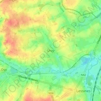
Name: Ghoy topographic map, elevation, terrain.
Location: Ghoy, Zinnik, Henegouwen, Wallonië, 7863, België (50.70834 3.78944 50.74834 3.82944)
Average elevation: 37 m
Minimum elevation: 14 m
Maximum elevation: 61 m