
Dongyang topographic map
Click on the map to display elevation.
Dongyang
Dongbai Mountain (东白山)'s highest peak, Taibai Peak) is the main peak of the Kuaiji Mountains, with an altitude of 1194.6 meters. The main peak is located in Hulu Town, Dongyang City, Zhejiang Province. Since ancient times, it has been the head of the famous mountains in central Zhejiang, the "roof" of Zhejiang's geography.
About this map
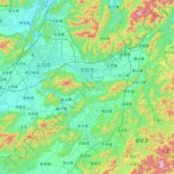
Name: Dongyang topographic map, elevation, terrain.
Location: Dongyang, Jinhua, Zhejiang, China (28.96890 120.07213 29.49869 120.73483)
Average elevation: 262 m
Minimum elevation: 28 m
Maximum elevation: 1,226 m
Other topographic maps
Click on a map to view its topography, its elevation and its terrain.