
Ulju-gun topographic map
Interactive map
Click on the map to display elevation.
About this map
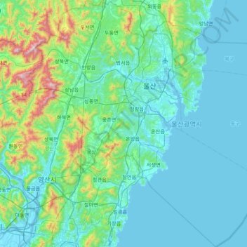
Name: Ulju-gun topographic map, elevation, terrain.
Location: Ulju-gun, Ulsan, South Korea (35.18617 128.97074 35.72449 129.60721)
Average elevation: 157 m
Minimum elevation: -3 m
Maximum elevation: 1,208 m