
Yugar topographic map
Click on the map to display elevation.
About this map
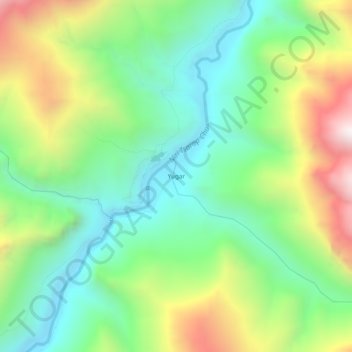
Name: Yugar topographic map, elevation, terrain.
Location: Yugar, Zanskar tehsil, Kargil district, Ladakh, India (33.24648 77.16276 33.28648 77.20276)
Average elevation: 4,223 m
Minimum elevation: 3,798 m
Maximum elevation: 4,998 m
Other topographic maps
Click on a map to view its topography, its elevation and its terrain.
Drang Drung Glacier
India > Ladakh > Zanskar tehsil
The Drang-Drung Glacier is likely to be the largest glacier in Ladakh after the Siachen Glacier in the Karakoram Range, with a maximum length of 23 km (14 mi) at an average elevation of 4,780 m (15,680 ft; 2.97 mi). The glacier lies in the northeastern Himalayan Range known as the Zanskar Range, 142 km (88 mi)…
Average elevation: 5,098 m