

Idlib topographic map
Click on the map to display elevation.
Idlib
Idlib (Arabic: إِدْلِب, romanized: ʾIdlib, pronounced [ʔid.lib]; also spelt Idleb or Edlib) is a city in northwestern Syria, and is the capital of the Idlib Governorate. It has an elevation of nearly 500 meters (1,600 ft) above sea level, and is 59 kilometers (37 mi) southwest of Aleppo. The city was taken over by Syrian revolution at the beginning of the Syrian Civil War in 2011, and by 2017 was the seat of the Syrian Salvation Government.
About this map
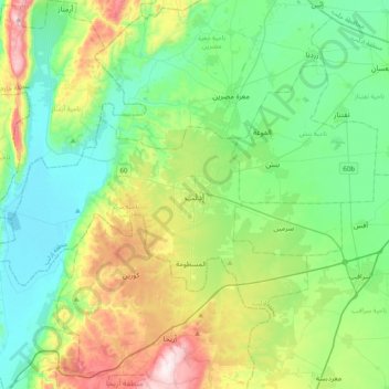
Name: Idlib topographic map, elevation, terrain.
Average elevation: 394 m
Minimum elevation: 212 m
Maximum elevation: 873 m
Other topographic maps
Click on a map to view its topography, its elevation and its terrain.

