
Hải Châu topographic map
Interactive map
Click on the map to display elevation.
About this map
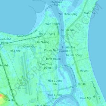
Name: Hải Châu topographic map, elevation, terrain.
Location: Hải Châu, Đà Nẵng, Vietnam (16.02204 108.18848 16.09999 108.23620)
Average elevation: 5 m
Minimum elevation: -3 m
Maximum elevation: 51 m
Other topographic maps
Click on a map to view its topography, its elevation and its terrain.
Thành phố Đà Nẵng
Vietnam > Đà Nẵng > Thành phố Đà Nẵng
Thành phố Đà Nẵng, Thanh Khê, Đà Nẵng, 236, Vietnam
Average elevation: 52 m