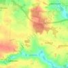
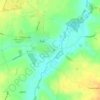
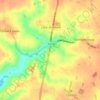
Great Ashfield topographic map
Click on the map to display elevation.
About this map

Name: Great Ashfield topographic map, elevation, terrain.
Location: Great Ashfield, Mid Suffolk, Suffolk, England, United Kingdom (52.25486 0.90734 52.27752 0.96165)
Average elevation: 63 m
Minimum elevation: 34 m
Maximum elevation: 74 m
Other topographic maps
Click on a map to view its topography, its elevation and its terrain.


Thorpe Street
United Kingdom > England > Suffolk > Mid Suffolk > Hinderclay > Thorpe Street
Average elevation: 36 m
Withersdale Street
United Kingdom > England > Suffolk > Mid Suffolk > Mendham > Withersdale Street
Average elevation: 38 m