
Rush topographic map
Click on the map to display elevation.
About this map
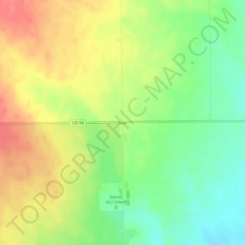
Name: Rush topographic map, elevation, terrain.
Location: Rush, El Paso County, Colorado, 80833, United States (38.81999 -104.11218 38.85999 -104.07218)
Average elevation: 1,835 m
Minimum elevation: 1,802 m
Maximum elevation: 1,869 m
Other topographic maps
Click on a map to view its topography, its elevation and its terrain.
Air Force Academy
United States > Colorado > El Paso County > Colorado Springs
The campus of the academy covers 18,455 acres (29 sq mi; 75 km2) on the east side of the Rampart Range of the Rocky Mountains, just north of Colorado Springs. Its elevation is normally given as 7,258 feet (2,212 m) above sea level, which is at the cadet area. The academy was designed by Skidmore, Owings and…
Average elevation: 2,158 m
Manitou Springs
United States > Colorado > El Paso County > Manitou Springs
Average elevation: 2,144 m
Peterson AFB Parade Grounds
United States > Colorado > El Paso County > Colorado Springs
Average elevation: 1,899 m
North Cheyenne Cañon Park
United States > Colorado > El Paso County > Colorado Springs
Average elevation: 2,224 m
Sleeping Giant
United States > Colorado > El Paso County > Colorado Springs
Average elevation: 1,971 m