
Bischofszell topographic map
Interactive map
Click on the map to display elevation.
About this map
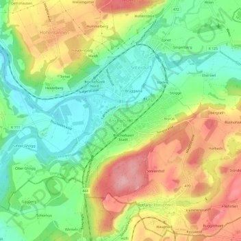
Name: Bischofszell topographic map, elevation, terrain.
Location: Bischofszell, Bezirk Weinfelden, Thurgovie, 9220, Suisse (47.47377 9.22092 47.51377 9.26092)
Average elevation: 527 m
Minimum elevation: 457 m
Maximum elevation: 619 m