
Itagüí topographic map
Interactive map
Click on the map to display elevation.
About this map
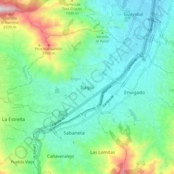
Name: Itagüí topographic map, elevation, terrain.
Location: Itagüí, Valle de Aburrá, Antioquia, 90261, Colombie (6.13244 -75.64933 6.21244 -75.56933)
Average elevation: 1,707 m
Minimum elevation: 1,491 m
Maximum elevation: 2,354 m