
Thank you for supporting this site ❤️
Make a donation
Make a donation
Atanquez topographic map
Click on the map to display elevation.
Thank you for supporting this site ❤️
Make a donation
Make a donation
About this map
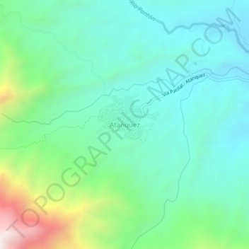
Name: Atanquez topographic map, elevation, terrain.
Location: Atanquez, Valledupar, Cesar, RAP Caribe, Colombia (10.67590 -73.37443 10.71590 -73.33443)
Average elevation: 900 m
Minimum elevation: 627 m
Maximum elevation: 1,733 m
Thank you for supporting this site ❤️
Make a donation
Make a donation
Other topographic maps
Click on a map to view its topography, its elevation and its terrain.