
Thank you for supporting this site ❤️
Make a donation
Make a donation
Ottenberg topographic map
Click on the map to display elevation.
Thank you for supporting this site ❤️
Make a donation
Make a donation
About this map
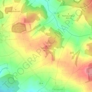
Name: Ottenberg topographic map, elevation, terrain.
Location: Ottenberg, Meeder, Landkreis Coburg, Beieren, 96484, Duitsland (50.36749 10.87852 50.36759 10.87862)
Average elevation: 460 m
Minimum elevation: 408 m
Maximum elevation: 507 m
Thank you for supporting this site ❤️
Make a donation
Make a donation