
Nghĩa Bình topographic map
Interactive map
Click on the map to display elevation.
About this map
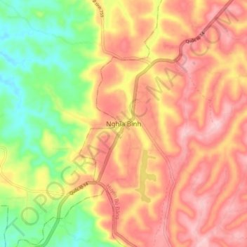
Name: Nghĩa Bình topographic map, elevation, terrain.
Location: Nghĩa Bình, Bù Đăng District, Bình Phước Province, Vietnam (11.62716 107.02215 11.70716 107.10215)
Average elevation: 231 m
Minimum elevation: 124 m
Maximum elevation: 313 m