Snead topographic map
Interactive map
Click on the map to display elevation.
About this map
![Snead topographic map, elevation, terrain](/pub/maps/way/k9zs/hbjflgp/thumbnail.jpg)
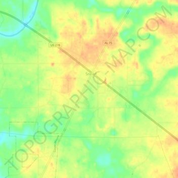
Name: Snead topographic map, elevation, terrain.
Location: Snead, Blount County, Alabama, United States (34.09486 -86.41462 34.13682 -86.36225)
Average elevation: 238 m
Minimum elevation: 215 m
Maximum elevation: 255 m
Other topographic maps
Click on a map to view its topography, its elevation and its terrain.
![Sulpher Springs topographic map, elevation, terrain](/pub/maps/node/b94s/dg496z4/icon.jpg)
Sulpher Springs
United States > Alabama > Blount County
Sulpher Springs, Blount County, Alabama, United States
Average elevation: 129 m
![Nyota topographic map, elevation, terrain](/pub/maps/node/7bnh/6bg3d9m/icon.jpg)
Nyota
United States > Alabama > Blount County
Nyota, Blount County, Alabama, 35172, United States
Average elevation: 142 m
![Appalachian topographic map, elevation, terrain](/pub/maps/node/2g3q/hlj1rrr/icon.jpg)
Appalachian
United States > Alabama > Blount County
Appalachian, Blount County, Alabama, United States
Average elevation: 324 m