
Thank you for supporting this site ❤️
Make a donation
Make a donation
Bagumbayan topographic map
Click on the map to display elevation.
Thank you for supporting this site ❤️
Make a donation
Make a donation
About this map
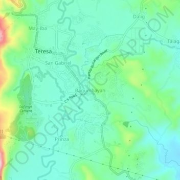
Name: Bagumbayan topographic map, elevation, terrain.
Location: Bagumbayan, Teresa, Rizal, Calabarzon, 1960, Philippines (14.53022 121.19872 14.57022 121.23872)
Average elevation: 68 m
Minimum elevation: 6 m
Maximum elevation: 260 m
Thank you for supporting this site ❤️
Make a donation
Make a donation
Other topographic maps
Click on a map to view its topography, its elevation and its terrain.