
Materborn topographic map
Interactive map
Click on the map to display elevation.
About this map
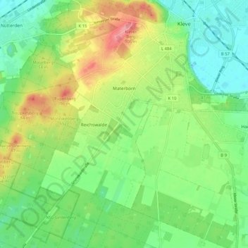
Name: Materborn topographic map, elevation, terrain.
Average elevation: 43 m
Minimum elevation: 9 m
Maximum elevation: 101 m
Other topographic maps
Click on a map to view its topography, its elevation and its terrain.
Rijn
Duitsland > Noordrijn-Westfalen > Kleef
Rijn, Salmorth, Kleef, Regierungsbezirk Düsseldorf, Noordrijn-Westfalen, 47533, Duitsland
Average elevation: 14 m