
La Albuera topographic map
Interactive map
Click on the map to display elevation.
About this map
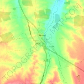
Name: La Albuera topographic map, elevation, terrain.
Location: La Albuera, Tierra de Badajoz, Badajoz, Extremadura, Spain (38.68766 -6.85135 38.73497 -6.75687)
Average elevation: 261 m
Minimum elevation: 224 m
Maximum elevation: 297 m