
Gjøvik topographic map
Interactive map
Click on the map to display elevation.
About this map
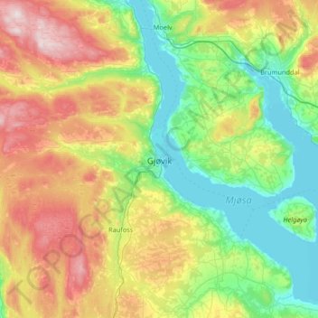
Name: Gjøvik topographic map, elevation, terrain.
Location: Gjøvik, Innlandet, 2815, Norway (60.75041 10.64993 60.83041 10.72993)
Average elevation: 225 m
Minimum elevation: 119 m
Maximum elevation: 434 m