
Thank you for supporting this site ❤️
Make a donation
Make a donation
Earls Barton topographic map
Click on the map to display elevation.
Thank you for supporting this site ❤️
Make a donation
Make a donation
About this map
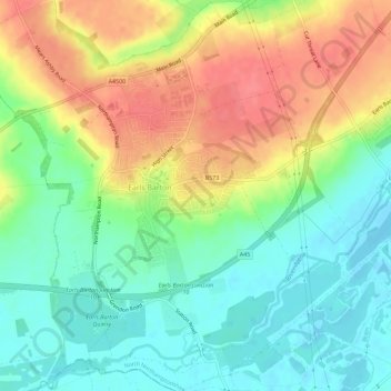
Name: Earls Barton topographic map, elevation, terrain.
Location: Earls Barton, North Northamptonshire, England, United Kingdom (52.24595 -0.77911 52.28086 -0.72195)
Average elevation: 70 m
Minimum elevation: 42 m
Maximum elevation: 106 m
Thank you for supporting this site ❤️
Make a donation
Make a donation