
Esberg topographic map
Interactive map
Click on the map to display elevation.
About this map
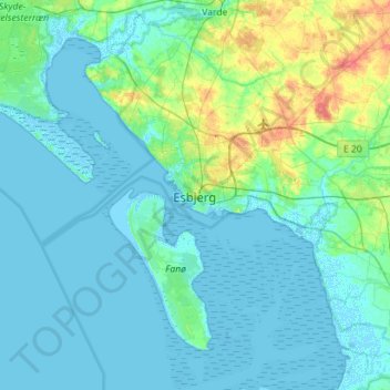
Name: Esberg topographic map, elevation, terrain.
Location: Esberg, Esbjerg Kommune, Region Süddänemark, 6700, Dänemark (55.30649 8.29208 55.62649 8.61208)
Average elevation: 7 m
Minimum elevation: -7 m
Maximum elevation: 48 m