
Barrage de Cleuson topographic map
Interactive map
Click on the map to display elevation.
About this map
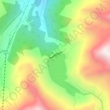
Name: Barrage de Cleuson topographic map, elevation, terrain.
Location: Barrage de Cleuson, Nendaz, Conthey, Valais, 1997, Suisse (46.11167 7.31943 46.11312 7.32406)
Average elevation: 2,282 m
Minimum elevation: 1,805 m
Maximum elevation: 2,863 m
Other topographic maps
Click on a map to view its topography, its elevation and its terrain.