
Thank you for supporting this site ❤️
Make a donation
Make a donation
Baldwyn topographic map
Click on the map to display elevation.
Thank you for supporting this site ❤️
Make a donation
Make a donation
About this map
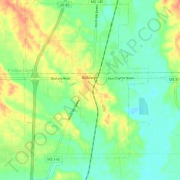
Name: Baldwyn topographic map, elevation, terrain.
Location: Baldwyn, Lee County, Mississippi, 38824, United States (34.46984 -88.66794 34.53946 -88.60805)
Average elevation: 109 m
Minimum elevation: 92 m
Maximum elevation: 135 m
Thank you for supporting this site ❤️
Make a donation
Make a donation
Other topographic maps
Click on a map to view its topography, its elevation and its terrain.