
Thank you for supporting this site ❤️
Make a donation
Make a donation
Englewood topographic map
Click on the map to display elevation.
Thank you for supporting this site ❤️
Make a donation
Make a donation
About this map
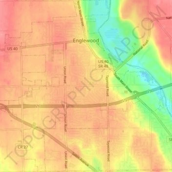
Name: Englewood topographic map, elevation, terrain.
Location: Englewood, Montgomery County, Ohio, 45322, United States (39.83274 -84.34340 39.89129 -84.26766)
Average elevation: 282 m
Minimum elevation: 232 m
Maximum elevation: 311 m
Thank you for supporting this site ❤️
Make a donation
Make a donation
Other topographic maps
Click on a map to view its topography, its elevation and its terrain.
Thank you for supporting this site ❤️
Make a donation
Make a donation
Thank you for supporting this site ❤️
Make a donation
Make a donation
Thank you for supporting this site ❤️
Make a donation
Make a donation