
Thank you for supporting this site ❤️
Make a donation
Make a donation
Dalig topographic map
Click on the map to display elevation.
Thank you for supporting this site ❤️
Make a donation
Make a donation
About this map
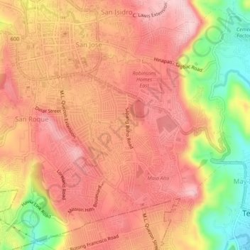
Name: Dalig topographic map, elevation, terrain.
Location: Dalig, Rizal, Calabarzon, 1670, Philippines (14.55297 121.16661 14.59297 121.20661)
Average elevation: 185 m
Minimum elevation: 49 m
Maximum elevation: 257 m
Thank you for supporting this site ❤️
Make a donation
Make a donation