
Thank you for supporting this site ❤️
Make a donation
Make a donation
El Khroub topographic map
Click on the map to display elevation.
Thank you for supporting this site ❤️
Make a donation
Make a donation
About this map
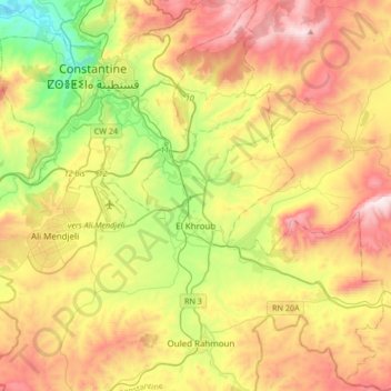
Name: El Khroub topographic map, elevation, terrain.
Location: El Khroub, El Khroub District, Constantine, Algeria (36.14596 6.52637 36.41680 6.78243)
Average elevation: 769 m
Minimum elevation: 315 m
Maximum elevation: 1,314 m
Thank you for supporting this site ❤️
Make a donation
Make a donation
Other topographic maps
Click on a map to view its topography, its elevation and its terrain.