
Thank you for supporting this site ❤️
Make a donation
Make a donation
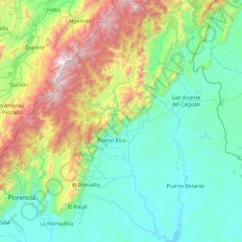
Puerto Rico topographic map
Click on the map to display elevation.
Thank you for supporting this site ❤️
Make a donation
Make a donation
Puerto Rico
The island is mostly mountainous with large coastal areas in the north and south. The main mountain range is called "La Cordillera Central" (The Central Range). The highest elevation in Puerto Rico, Cerro de Punta 4,390 feet (1,340 m), is located in this range.
Thank you for supporting this site ❤️
Make a donation
Make a donation
About this map
Name: Puerto Rico topographic map, elevation, terrain.
Location: Puerto Rico, Caquetá, Amazonia, Colombia (1.38758 -75.34858 2.62838 -74.78266)
Average elevation: 846 m
Minimum elevation: 207 m
Maximum elevation: 3,444 m
Thank you for supporting this site ❤️
Make a donation
Make a donation