
Suhre topographic map
Interactive map
Click on the map to display elevation.
About this map
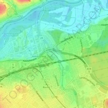
Name: Suhre topographic map, elevation, terrain.
Location: Suhre, Im Hag, Buchs, Bezirk Aarau, Argovie, 5033, Suisse (47.38840 8.06601 47.40622 8.07685)
Average elevation: 379 m
Minimum elevation: 358 m
Maximum elevation: 414 m