Bni Ansar بني انصار topographic map
Interactive map
Click on the map to display elevation.
About this map
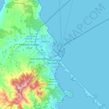
Name: Bni Ansar بني انصار topographic map, elevation, terrain.
Average elevation: 113 m
Minimum elevation: -2 m
Maximum elevation: 871 m

Click on the map to display elevation.
Name: Bni Ansar بني انصار topographic map, elevation, terrain.
Average elevation: 113 m
Minimum elevation: -2 m
Maximum elevation: 871 m